Autodesk ReCap Pro เป็นโปรแกรมที่ช่วยในการนำเข้าไฟล์ ตรวจดู และสแกนข้อมูลมาแปลงให้เป็น point could เพื่อการออกแบบสร้างแบบจาลอง 3 มิติ ได้รับการพัฒนาให้สามารถสร้างแบบจำลอง 3 มิติ ได้อย่างละเอียดในเวลาเพียงไม่กี่นาทีด้วยการสแกนเลเซอร์และรูปภาพจะถูกบันทึกไว้โดยอัตโนมัติ มีการประมวลผลที่ใช้ระยะเวลาน้อย จึงมีเวลามากขึ้นที่จะมุ่งเน้นงานที่สำคัญในส่วนอื่นๆ ได้ เหมาะสำหรับอาคารเก่าที่ไม่มีข้อมูลแบบอาคาร หรือ อาคารที่ต้องการโมเดลภาพรวมแบบเร่งด่วน
มีอะไรใหม่ใน Autodesk ReCap Pro
- สามารถทำการนำเข้าไฟล์โมเดล CAD เข้ามาในโปรแกรม ReCap ได้
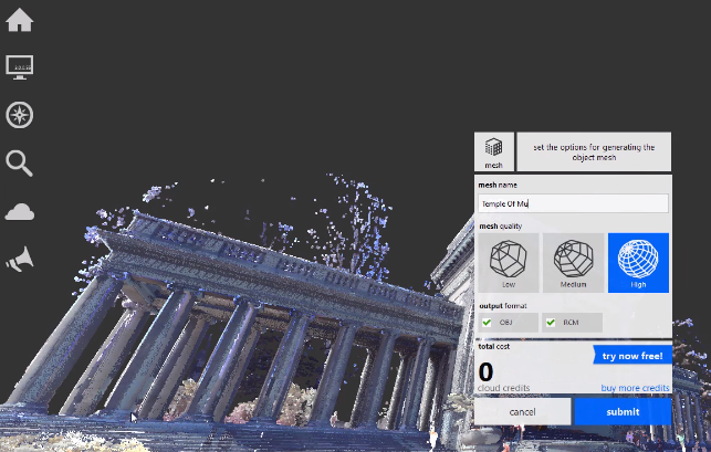
- เพิ่มความสามารถในการนำเข้าไฟล์ Scan มาสร้างโมเดลให้ละเอียดมากขึ้นด้วยคำสั่ง Scan to Mesh ทำให้โมเดลที่ได้ออกมามีความละเอียดมากขึ้นด้วยการปรับ Mesh Quality
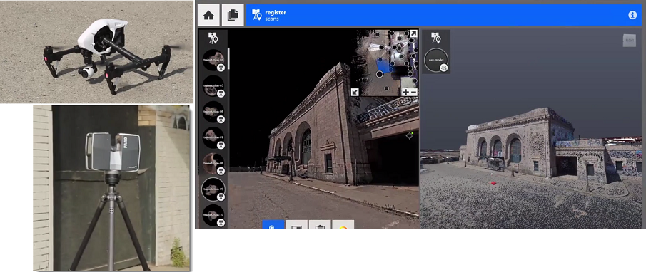
- เพิ่มประสิทธิภาพการทำงานด้วยการ Combine ไฟล์ที่ได้จากเครื่อง Laser Scan กับ Drone ที่ใช้บินเก็บข้อมูล ทำให้ข้อมูลโมเดลที่ได้มีความละเอียดสูงมากขึ้น
- สามารถทำการแก้ไขข้อมูลเฉพาะส่วนได้อย่างง่ายดาย โดยสามารถทำการเลือกโมเดลตามประเภทของข้อมูลที่มีอยู่ได้ทันที ทำให้การทำงานสะดวกมากขึ้น
คุณสมบัติพิเศษของ Autodesk ReCap
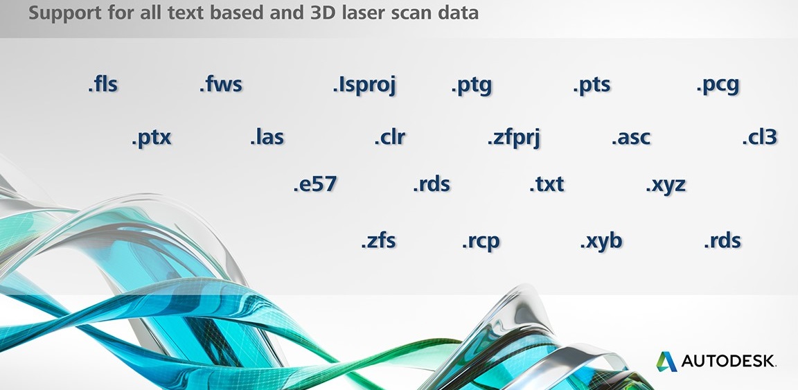
- อิมพอร์ตไฟล์ได้หลายรูปแบบ ในการสแกนจะรองรับทุกไฟล์หลักที่สำคัญ เช่น .las หรือ .rcs และยังรองรับข้อมูล ช้อความ และสแกนเลเซอร์ 3 มิติ ทั้งหมด
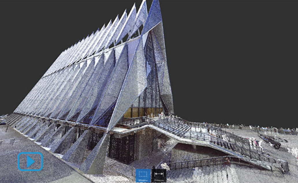
- มีมุมมองภาพที่เสมือนจริงกับของวัตถุจริง สามารถสร้างภาพแบบพาโนรามา 2.5D ที่เหมือนจริง จากการใช้เครื่อง Laser Scan ได้
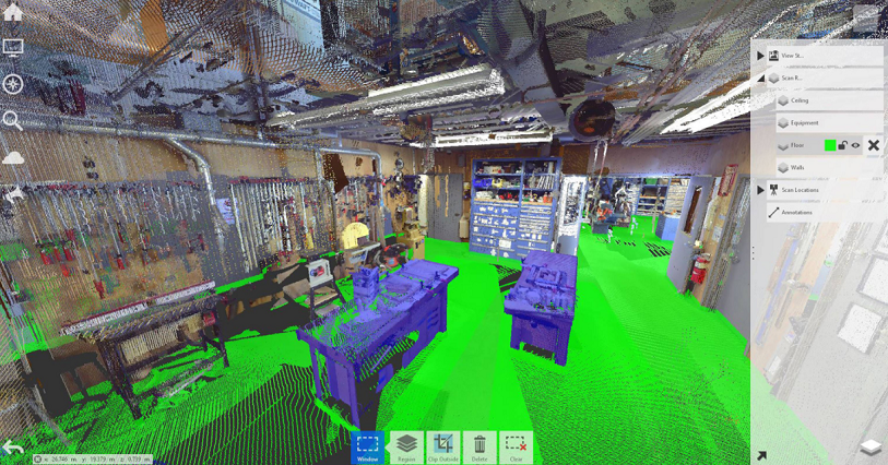
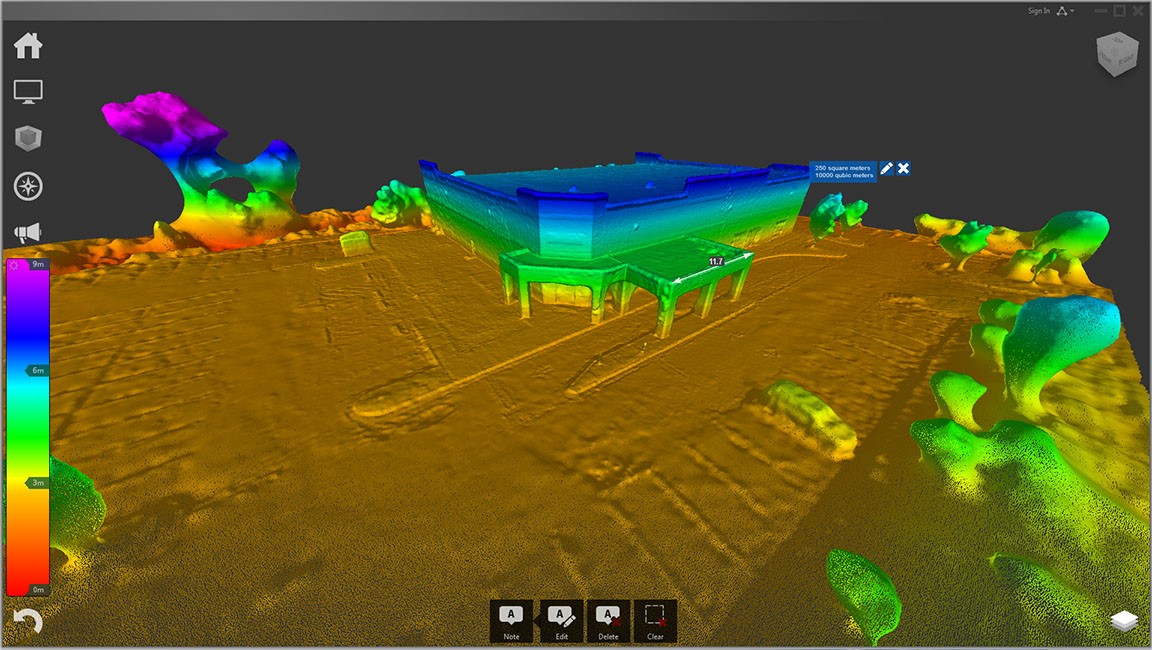
- การตรวจดูและแก้ไข point could มีเครื่องมือที่สามารถนำมาใช้ได้งานง่าย
- การสแกนและบันทึกข้อมูลอัตโนมัติ ช่วยประหยัดเวลาด้วยการบันทึกข้อมูลแบบอัตโนมัติ
- การรายงานผลที่ถูกต้องและควบคุมการสำรวจ มีการปรับปรุงความถูกต้องในการประเมินผลคุณภาพเมื่อทำการสำรวจ
- การสร้างภาพข้อมูลที่เสมือนจริง มีการสร้างภาพที่มีประสิทธิภาพ รองรับชุดข้อมูลขนาดใหญ่ ที่มีภาพคมชัด สมจริงเต็มรูปแบบ 3D หรือดูการสแกนแบบพาโนรามา
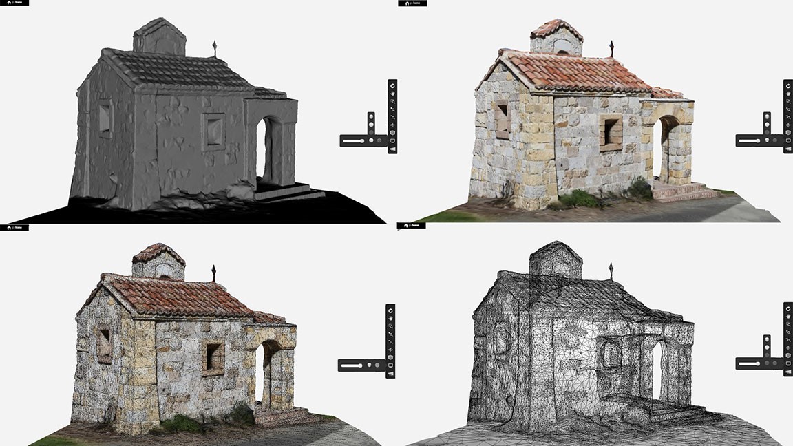
- รวมภาพถ่ายและการสแกนเลเซอร์เพื่อสร้างแบบจำลอง สร้างความถูกต้องแม่นยำของ point could ได้โดยการรวมภาพถ่ายและการสแกนเลเซอร์ มีการจัดวางตำแหน่งเลเซอร์ point could พร้อมรูปถ่ายตาม point could เพื่อสร้างแบบให้อยู่ในงานเดียวกัน
- ถ่ายภาพเสมือนจริงผ่านมุมมองพื้นที่จริง สามารถเลือกและแชร์มุมมองเฉพาะที่ของงาน โดยไม่ต้องแชร์ทั้งชุดข้อมูลของ point could ผ่านมุมมองพื้นที่จริง
- มีเครื่องมือในการนำเสนอแบบวิดีโอ สามารถสร้างวิดีโอจากแบบจำลองเสมือนจริงได้
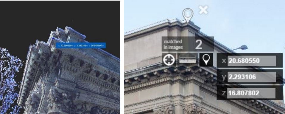
- เครื่องมือการตรวจวัดขั้นสูง มีการตรวจวัดวัตถุที่เร็วขึ้น ตรวจสอบระยะทางของวัตถุทรงกระบอกและแนวระนาบได้ง่ายขึ้น ด้วยรูปทรงที่เหมาะสมโดยอัตโนมัติ ตรวจวัด Snap จากจุดหนึ่งไปยังอีกจุดที่เลือกได้รวดเร็วขึ้น
- Markup และการติดแท็ก Markup และการติดแท็กภายใน point could จะสามารถแบ่งปันกับสมาชิกคนอื่นๆ ในทีมได้ เพิ่มข้อความ รูปภาพ และ Link ไปยังคำอธิบายประกอบได้ และแบ่งปัน Markup เหล่านี้เพื่อทำงานร่วมกันกับผู้อื่นได้
- ค้นหาและ sync สามารถค้นหา, sync Markup และแท็ก ที่มีการทำงานร่วมกันหลายคนได้อย่างรวดเร็ว การ sync จะช่วยให้สามารถแบ่งปันและติดตามการเปลี่ยนแปลงทั้งหมดกับสมาชิกทุกคนในทีม
- บริการล้างข้อมูลอัตโนมัติ ลบวัตถุที่ไม่ต้องการออกจากแบบจำลองได้อย่างง่ายดายโดยอัตโนมัติ ของวัตถุที่เคลื่อนที่ทั้งหมด เช่น คนเดิน ด้วยเครื่องมือการทำความสะอาดอันชาญฉลาด
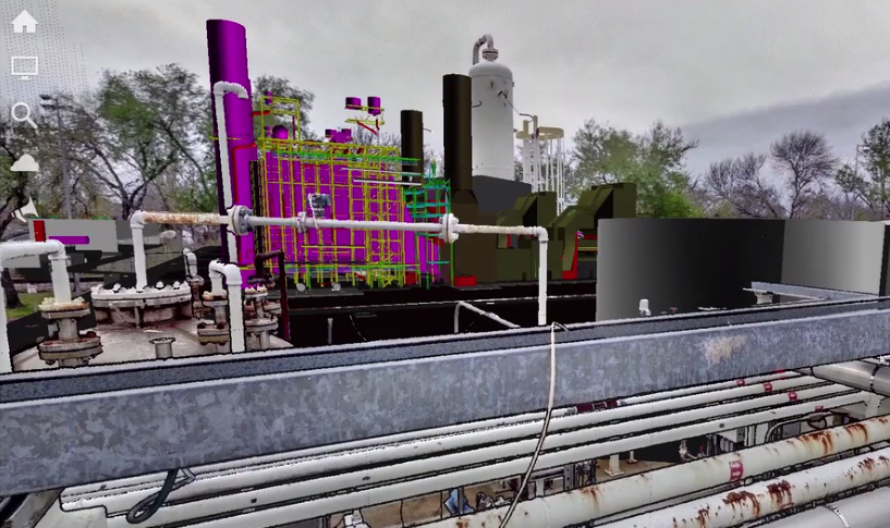
- สร้างพื้นผิว 3D ในรูปแบบกริด สามารถแปลง point cloud ลงในพื้นผิวตาข่าย 3D โดยการเลือกสแกนรอบวัตถุที่ต้องการเปลี่ยนเป็นภาพพื้นผิวแบบกริด เช่น อุปกรณ์ในโรงงาน
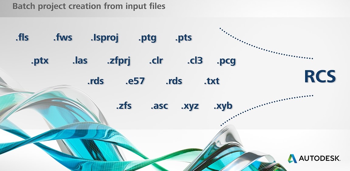
- สร้างชุดงานจากแฟ้มข้อมูล จะส่งออกการสแกนข้อมูลไปในรูปแบบ RCS โดยอัตโนมัติ ซึ่ง RCS เป็นรูปแบบพื้นฐานสำหรับซอฟแวร์ Autodesk ทั้งหมด
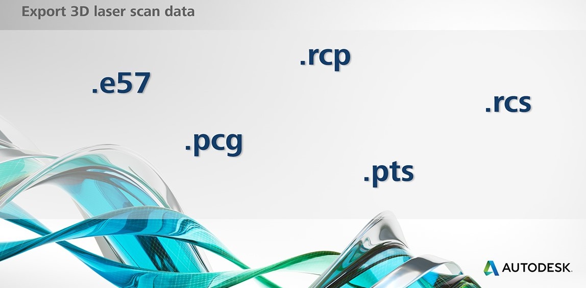
- การส่งออกในรูปแบบต่างๆ point clouds จะสามารถส่งออกไปใน RCP/RCS, E57, PTS, และ PCG
Fly in Autodesk ReCap Pro
- อิมพอร์ตภาพถ่ายแนวตรงและภาพถ่ายพาโนรามา รองรับกล้องและเลนส์แนวตรง นอกจากนี้ยังสนับสนุนเลนส์ fish-eye ในกล้อง GoPro อีกด้วย
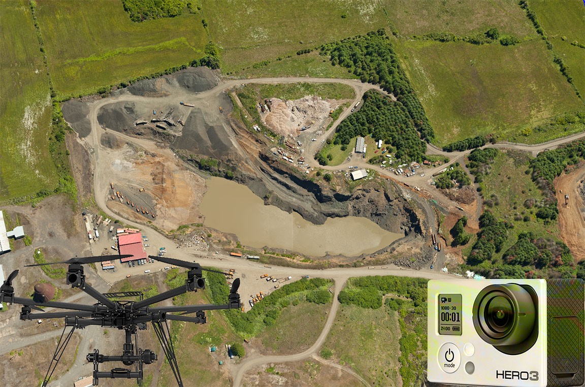
- อิมพอร์ตภาพจากกล้อง GoPro สามารถใช้กล้อง GoPro ในการจับภาพในระยะทางสั้นๆ จากแผ่นดิน ทะเล หรือทางอากาศ สำหรับการสร้างแบบจำลอง 3 มิติใน Autodesk ReCap
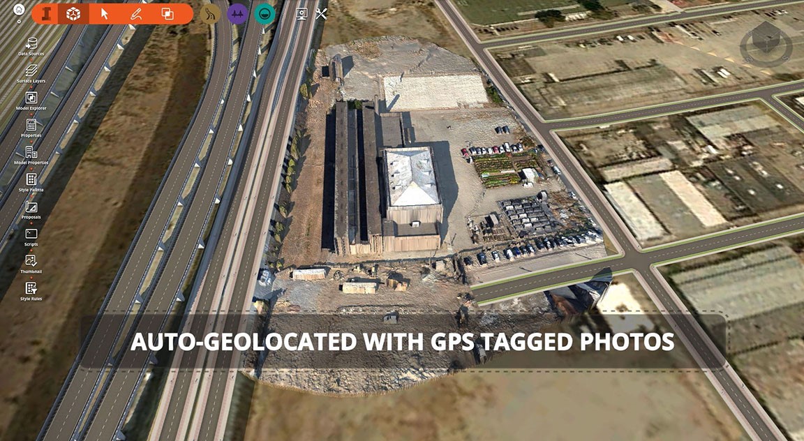
- รองรับการแท็ก GPS ใน EXIFs มีการใช้ข้อมูลเมตะ GPS ที่ฝังอยู่ในการแลกเปลี่ยนไฟล์ภาพ (EXIF) โดยแต่ละรูปภาพจะปรับขนาดอัตโนมัติ และระบุตำแหน่งทางภูมิศาสตร์ลงที่ภาพ
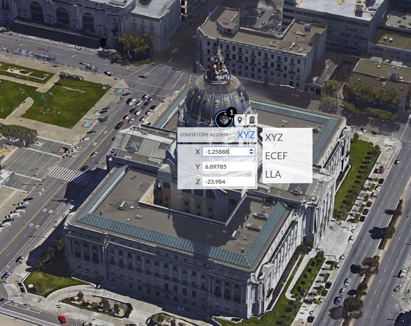
- นำเข้าจุดควบคุมภาคพื้นดิน เพิ่มการตรวจวัดการสำรวจที่แม่นยำหรือจุดควบคุมภาคพื้นดิน (GCPs) ในการประมวลผล เพื่อปรับปรุงความแม่นยำในทางเรขาคณิตหรือปรับตำแหน่งให้สอดคล้องกับภาพตาม point could ด้วยเลเซอร์ point could ที่ใช้ข้อมูลจากการสำรวจเดียวกัน ซึ่งรองรับระบบพิกัดทั่วไปทั้งหมดรวมถึงรูปแบบ X, Y, Z ECEF และ LLA-WGS84
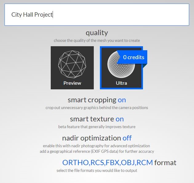
- จากภาพถ่ายแปลงไปยังรูปแบบกริดในรูปแบบ RCM, OBJ, FBX ได้อัตโนมัติ สามารถสร้างพื้นผิวภาพถ่ายแบบจำลอง 3 มิติคุณภาพสูง ในรูปแบบที่ใช้มากที่สุด โดย OBJ สำหรับพื้นผิวแบบกริด, FBX สำหรับพื้นผิวแบบ - ข้อมูลจากกล้องถ่ายภาพ 3 มิติ, และ RCM
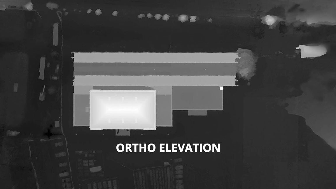
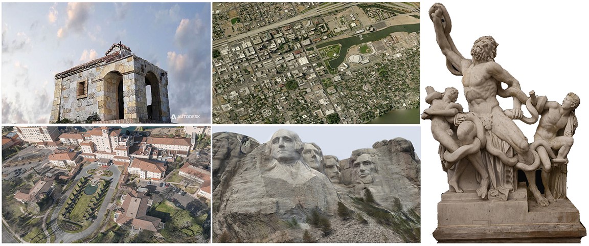
- สร้าง orthographic อัตโนมัติ สร้างภาพฉายความละเอียดสูงและแผนที่ที่มีความลึก ในรูปแบบของ Geo TIFF ซึ่งในโปรแกรม Autodesk InfraWorks และซอฟแวร์ GIS อื่นๆ นอกจากนี้ก็สามารถใช้ภาพเหล่านี้ได้
- การสร้าง point cloud อัตโนมัติ สร้าง point clouds 3 มิติ ในรูปแบบ RCS ที่มีความหนาแน่นสูง แก้ไขหรือใช้ point cloud เหล่านี้ใน Autodesk ReCap หรือซอฟแวร์ Autodesk design
- เพิ่มหรือ stitch ภาพด้วยตนเอง
- ดูตัวอย่างและแบ่งปันภาพ 3 มิติ แบบกริด มีการแสดงภาพตัวอย่างบนเว็บ และสามารถที่จะดูแบบจำลอง 3 มิติ ในแบบร่าง ก่อนการดาวน์โหลดข้อมูลที่มีความละเอียดเต็ม และสามารถแบ่งปันตัวอย่างนี้ได้กับทุกคน
- ความสามารถคู่ขนาน สามารถเรียกใช้หลายงานได้ในเวลาเดียวกัน
การแบ่งปันและการทำงานร่วมกัน
- แบ่งปันและทำงานร่วมกันกับ Autodesk A360 ทำงานร่วมกันอย่างเต็มที่กับ Autodesk A360 ซึ่งแผงควบคุมเฉพาะที่ จะช่วยให้ผู้ใช้สามารถดูการสแกนเลเซอร์หรือภาพงานใน UAV
- Markup, sync, และการค้นหา เตรียมความพร้อมของงานได้โดยตรงจากระบบ cloud ใส่คำอธิบายประกอบและแบ่งปันเลเซอร์สแกนจาก desktop ไปยัง cloud สำหรับการตรวจดูและทำงานรวมกันกับผู้อื่นในบัญชี Autodesk A360
Compare releases
Autodesk ReCap vs. Autodesk ReCap Pro
|
Product |
ReCap | ReCap Pro |
| Features | ||
| Laser Scan Features | ||
| Import Scan Various Formats | ✔ | ✔ |
| Real Views (panorama visualization) |
✔ |
✔ |
| Point cloud viewing, Editing and cleaning |
✔ |
✔ |
| Automatic registration |
|
✔ |
| Accuracy reports & survey control |
|
✔ |
| Target-based registration refinement and registration rollback |
|
✔ |
| Photorealistic data visualization |
✔ |
✔ |
| Alignment of laser point clouds with photo-based point clouds | ✔ | ✔ |
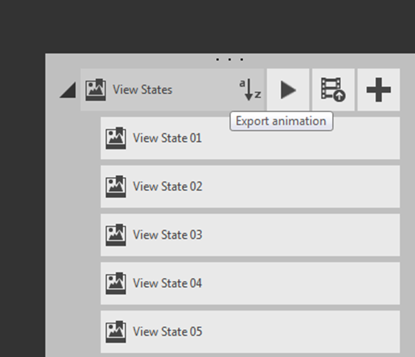
| Real View States | ✔ | ✔ |
| Video tool | ✔ | |
| Advanced measurement tool | ✔ | |
| Markup and Tagging | ✔ | |
| Search and Sync | ✔ | ✔ |
| Access to cleanup service (new with 3.0) | ✔ | |
| Access to Scan-to-mesh service (new with 3.0) | ✔ | |
| Batch project Creation from input filea (new with 3.0) | ✔ | |
| Export in various formats (RCP/RCS,E57,PTS,PCG) | ✔ | ✔ |
| UAV Features | ||
| Import photo in any rectilinear format | ✔ | |
| Import GoPro image (hero 3+ and Hero 4 Black Editions) | ✔ | |
| Support GPS tags in EXIFs to automatically scale and Geolocate the scene | ✔ | |
| Import Ground Control Point in X, Y, Z, ECEF & LLA - WG584 formats | ✔ | |
| Automatic photo-to-meshin RCM, OBJ, FBX formats | ✔ | |
| Automatic photo-to-orthoview and depth map | ✔ | |
| Automatic photo-point-cloud in RCP/RCS format | ✔ | |
| Add images and manual stitch | ✔ | |
| Web preview of the computed 3D mesh | ||
| Possibility to run multiple projects in parallel |
✔ |
|
| Sharing and Collaboration | ||
| ReCap 360 dashboard & A360 cloud storage, sharing and collaboration tool | ✔ | ✔ |
| Markup, Sync, and Search laser in A360 | ✔ | |
ซินเนอร์จี้ซอฟต์ ตัวแทนจำหน่ายซอฟต์แวร์อย่างเป็นทางการและถูกต้องในประเทศไทยของออโตเดสก์ สำหรับท่านที่ต้องการทราบข้อมูลเพิ่มเติมเกี่ยวกับผลิตภัณฑ์ สามารถสอบถามได้ทางเจ้าหน้าที่ซินเนอร์จี้ซอฟต์ที่
ต้องการเริ่มต้นใช้งาน Autodesk AEC Collection ใช่ไหม ?
ไม่ว่าคุณจะต้องการทดลองดูการทำงานจริง ขอคำแนะนำ Package ขอใบเสนอราคา หรือเรียนรู้การใช้งานเพิ่มเติม Synergysoft พร้อมช่วยให้คุณเริ่มต้นกับ Autodesk AEC Collection ได้ง่ายขึ้น พร้อมคำแนะนำจากทีมงานที่เข้าใจซอฟต์แวร์สำหรับงาน